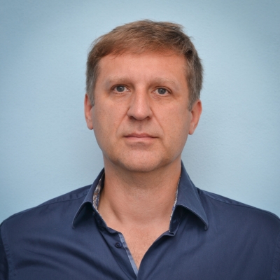
Prof. Vít VOŽENÍLEK
+420 585-63-4513
vit.vozenilek@upol.cz
office no. 2.13
office hours: by appointment
Research
Thematic cartography, atlases, modelling in GIS, spatial awareness
Education
2007 – VSB-Technical University Ostrava – full professor in geoinformatics
1996 – Faculty of Science, Palacky University, Olomouc – associate professor in physical geography
1992 – Faculty of Science, Masaryk University, Brno – Ph.D. in physical geography
1988 – Faculty of Science, Masaryk University, Brno – MSc. in geography and mathematics
Experience
2014: Pennsylvania State Univrsity (4 months, Fulbright grant)
2010-2014: vice-rector of Palacky University Olomouc
2001-present: head of Dept. of Geoinformatics Palacky University Olomouc
2003-2009: Charles University in Prague, associated professor and full professor
2007-present: Faculty of Science, Palacky University Olomouc, full professor
1996-2007: Faculty of Science, Palacky University Olomouc, associated professor
1994: Unuversity of Maria Curie-Sklosowska (2 months, research visit)
1993: Birkbeck College London (6 months, Masaryk scholarship)
1992-1996: Faculty of Science, Palacky University Olomouc, assistant professor
1990-1992: Faculty of Science, Palacky University Olomouc, assistant
1989-1990: PhD study
1988: Elementary School Vyškov, teacher
Membership in professional organisations
International Cartographic Association
- vice-president (2015-present)
- member of Commission on education (1999-2003)
- member of Commission for Atlases (2007-present)
International Geographical Union
- member of Commission on GIS (2007-2014)
Czech Cartographic Society (from 1990)
- vice-president (2012-present)
- member of Steering Committee (1995-present)
Czech Geographical Society (from 1987)
- member of Steering committee (1993-2007)
- head of Central Moravian Division (1993-2001)
- head of GIS commission (1996-2007)
National Geographical Committee
- member (2001-2008, 2014-present)
Czech Association for Geoinformation (from 1994)
- member of Executive committee (1994-2004)
- co-chair of Commission on education (1994-2008)
Membership in academic boards:
Academic Board of Palacky University Olomouc (2018-present)
Academic Board of Faculty of Science, Palacky University Olomouc (1998-2002, 2008-present)
Academic Board of Faculty of Physical Culture, Palacky University Olomouc (2014-present)
Academic Board of Faculty of Mining and Geology, VSB-Technical University Ostrava (2014-present)
Academic Board of College of logistics, Přerov (2007-2017)
National group „Information and Communication Technologies“ of Horizon2020 (2014-present)
International Council “Visegrad Fund” (2012-2015)
Academic Board of Ostrava University in Ostrava (2003-2007)
Academic Board of Faculty of Science, Charles University in Prague (2002-2004)
Academic Board of Geographic section at Faculty of Science, Charles University in Prague (2002-2009)
Membership in editorial and advisory boards of scientific journals:
Geography (journal with IF) (1996-present) http://geography.cz/sbornik/
International Journal of Cartography (2014-present) http://www.tandfonline.com/loi/tica20#.VyA0tXxf3ug
Polski Przeglad Kartograficzny / Polish Cartographic Review (2012 -present) http://ppk.net.pl/en_akcja1.php?rok=2015&numer=1
Journal of Environment Geography (2012-present) http://www.geo.u-szeged.hu/journal/
Series M.A.P.S. (2009-present, chairman)
Meteorologické zprávy / Meteorological Bulletin (2012-present) http://casmz.chmi.cz/
Dnešní svět / Today’s world (2007-present) http://www.dnesni-svet.cz/casopis/
Lecturing
Teaching experience (since 1989):
Geographic cartography
Thematic cartography
Computer cartography
Geographic information systems
Digital elevation models
Modelling in GIS
State information policy
Analysis of cartographic products
Atlas cartography
Academic writing in GIScience
Supervision of PhD candidates:
Technical approach for GPS implementation into system of data capturing in coal excavator in the Bílina Mine (Ivan Bílý, VSB-Technical University Ostrava, 2005)
Cartographical visualization of spatial databases of regional information systems (Zdena Dobešová, VSB-Technical University Ostrava, 2008)
Assessment of tourism on landcscape of Nízký Jeseník, Mts. in GIS (Aleš Ruda, Ostrava University Ostrava, 2008)
Modelling of labor market using multicriterial assessment (Kamila Slováková, VSB-Technical University Ostrava, 2009)
Geomorphological information systems (Karel Jedlička, VSB-Technical University Ostrava, 2010)
Cartographical aspects of Earth remote sensing documents (Luboš Bělka, Charles University in Prague, 2012)
Implementation of geoinformation technologies into modelling of urbanization processes within strategic planning of urban development (Jaroslav Burian, Charles University in Prague, 2012)
Evaluation of DEM quality for environmental applications (Jana Svobodová, Ostrava University Ostrava, 2011)
Photogrammetry in geodata capturing using unmanned automatic vehicles (Jakub Miřijovský, Palacky University Olomouc, 2013)
Advanced methods for landslide assessment using GIS (Miloš Marjanovič, Palacky University Olomouc, 2013)
Non-technologic aspects of map production in atlas cartography (Alena Vondráková, Palacky University Olomouc, 2013)
Phenological Mapping of Landscape with GIT (Aleš Vávra, Palacky University Olomouc, 2014)
Evaluation of 3D visualization in GIS using eye-tracking (Stanislav Popelka, Palacky University Olomouc, 2014)
Color distance in cartography (Alžběza Brychtová, Palacky University Olomouc, 2015)
Spatial information and selected geocomputational methods for its evaluation (Vít Pászto, Palacky University Olomouc, 2015)
Geoinformatic approach for spatial data management in public transportation at the regional level (Lenka Zajíčková, Palacky University Olomouc, 2017)
Airborne Thermal Remote Sensing in Urban Climate Research (Tomáš Pour, Palacky University Olomouc, 2019)
Publishing
ResearchGate – https://www.researchgate.net/profile/Vit_Vozenilek